+500 new subscribers
Looking for Jobs?
By signing up, you agree to our privacy policies you can find on our website.
Perfect! We'll keep you up to date about current jobs from now on!
Oops! That didn't work out.
+500 new subscribers


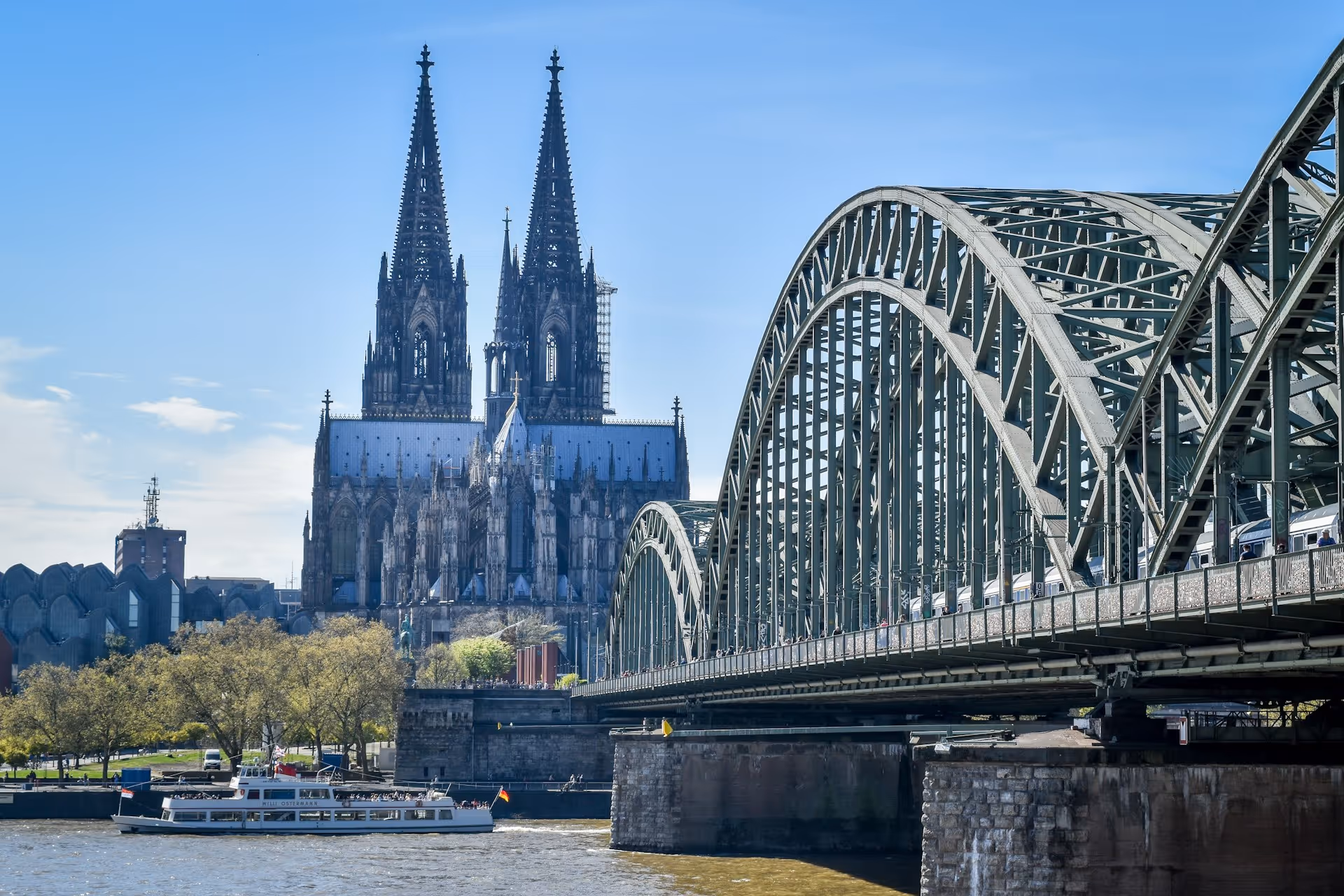
Working and living in Berlin: Your career location for environment, planning and geodata
Berlin, the vibrant capital with 3.7 million inhabitants, is Germany's largest metropolis and a European center for innovation, culture and sustainability. The city represents a unique mix of history, creativity and future orientation. As the seat of government and the location of numerous federal agencies, international companies and research institutions, offers Berlin ideal conditions for experts in the areas of environment, planning and geodata. The metropolis between Spree and Wannsee scores points for its cultural diversity, dynamic start-up scene and exceptional quality of life with urban neighborhoods and extensive green spaces. Living in Berlin means being part of a constantly changing city that combines big city flair with affordable living space and countless career opportunities.
The job market in Berlin offers outstanding prospects for specialists in the fields of environment, planning and geodata. As the location of TU Berlin with the Department of Geoinformation in Environmental Planning and the Berlin University of Applied Sciences with the degree programs Geoinformation and Environmental Information-GIS Berlin has developed into a leading center for GIS jobs Berlin, geoinformatics Berlin and innovative geodata solutions. Urban planning in Berlin benefits from ambitious projects such as the development of new urban districts, sustainable mobility concepts and climate adaptation. Berlin surveyors, geoinformatics specialists and environmental technology specialists in Berlin, who are involved in pioneering projects in the growing capital, are particularly in demand.
Die Senate Department for Urban Development, Construction and Housing employs numerous city planners, spatial planners, traffic planners and geodata experts. Vacancies in spatial planning Berlin can be found both in public administration and at internationally active companies such as Sweco, con terra or ARC-GREENLAB. Die Berliner Wasserbetriebe As the largest German water and wastewater company, it offers a wide range of career opportunities for GIS specialists and surveyors in geodata services. Start-ups and technology companies are also creating innovative jobs in the areas of location-based services and smart cities. The close integration between research, administration, established companies and start-ups creates a dynamic environment for geodata jobs in Berlin and environmental jobs in Berlin.
Working in Berlin means living in a city that stands out for its diversity, creativity and liveliness. The cost of living is lower than in Munich, Frankfurt or Hamburg, even though rental prices have risen in recent years. The housing market offers a wide range of options from trendy neighborhoods such as Kreuzberg, Neukölln and Friedrichshain to family-friendly districts such as Prenzlauer Berg and Charlottenburg to green suburbs such as Zehlendorf or Pankow. Living in Berlin makes it possible to benefit from the incomparable cultural diversity and urban lifestyle.
The transport connections are excellent: The dense subway, S-Bahn, tram and bus network ensures the best inner-city mobility. BER airports and future transport projects connect Berlin with the world. The well-developed cycle path network makes Berlin increasingly bicycle-friendly. Berlin's work-life balance benefits from the unique combination of culture, nature and leisure activities: parks such as Tiergarten, Tempelhofer Feld and Grunewald offer relaxation, lakes such as Wannsee and Müggelsee invite you to enjoy water sports. Culturally, Berlin is second to none with over 170 museums, three opera houses, numerous theaters, galleries, clubs and an international gastronomic scene.
Berlin's job opportunities are excellent for environmental, planning and geospatial professionals and offer long-term development opportunities in Germany's most dynamic metropolis. TU Berlin with its renowned field of geoinformation in environmental planning and the Berlin University of Applied Sciences with its geoinformation and environmental information-GIS courses offer first-class academic education and research opportunities. Humboldt University and Freie Universität complement their academic offerings with geography and earth science courses.
The excellent network between universities, research institutions, federal authorities, state administration and industry creates ideal conditions for career development. Numerous continuing education opportunities, specialist conferences and networking events expand career prospects. The job offers for spatial planning Berlin and related areas will continue to grow as the city pursues ambitious goals in the areas of climate neutrality, sustainable mobility, smart cities and affordable housing. For qualified specialists, Berlin not only offers an attractive place to work with an international focus and moderate living costs, but also the opportunity to participate in pioneering projects in the German capital and actively shape the transformation of an entire metropolis.
Leading employer for environmental, planning and geospatial jobs in Berlin
Berlin offers an exceptionally diverse employer landscape for specialists in the fields of environment, planning and geodata. From federal authorities to state administrations, international consulting firms, innovative start-ups and research institutions — career opportunities in the GIS sector, environmental planning and geodesy are particularly diverse in the capital and are constantly growing.
Senate Department for Urban Development, Construction and Housing
The Senate Administration is responsible for urban planning, urban development, land use planning and residential construction in the capital. City planners, spatial planners, architects and traffic planners work here on Berlin's future with tasks in land use planning, development planning and strategic urban development. The geoinformation department operates extensive geodata infrastructures and provides basic geodata for administration and the public.
Senate Department for Mobility, Transport, Climate Protection and Environment
This senate administration coordinates nature conservation, climate protection, environmental protection, urban greenery and transport planning. Environmental engineers, biologists, landscape planners, climate protection managers and traffic planners are working on Berlin's ecological transformation. The GRIS green space information system uses modern GIS technology to manage Berlin's green and open spaces.
With over 4,600 employees, Berliner Wasserbetriebe is the largest company in the water and wastewater sector in Germany. The Geodata Services division employs GIS specialists, surveyors, geoinformatics specialists and CAD specialists to provide technical data for planning and building works and networks. The company offers secure jobs in critical infrastructure with modern geodata systems.
Berlin District Offices — Surveying Offices and Urban Planning Offices
The twelve districts of Berlin employ surveyors, urban planners and civil engineers in their surveying and urban planning offices for local land use planning, surveying and geodata administration.
ARC-GREENLAB is an interdisciplinary service and software company with 130 employees in Berlin, Hanover and Eisenhüttenstadt. The focus is on surveying, geoinformation systems, forestry and environment, and building information modelling. Surveyors, GIS specialists, geoinformatics specialists and BIM coordinators work on engineering surveying, network documentation and GIS projects. The company offers a wide range of job opportunities in the office and in the field.
con terra is a platinum partner of Esri and value-added reseller of Safe Software and specializes in GIS solutions and web GIS development. GIS consultants, web GIS developers, geoinformatics specialists and software architects design and implement innovative web applications based on the latest GIS technology. The company offers ambitious projects and close cooperation with leading technology providers.
Sweco is Europe's largest architecture and engineering firm with an important presence in Berlin. Urban planners, landscape planners, environmental planners, traffic planners and GIS specialists work on national and international projects in spatial and environmental planning, transport and infrastructure. The company offers international career prospects and interdisciplinary work.
Planungpiloten is an innovative planning office for infrastructure and mobility. GIS specialists, geodata specialists and geoinformatics specialists are working on the digitization of transport infrastructure using modern GIS and BIM methods. The company offers work-life balance with a 38-hour week and flexible working models.
Schüssler-Plan is a renowned engineering firm for traffic facilities and landscape planning. Technical staff for GIS/BIM, landscape planners and CAD draftsmen create sophisticated GIS/CAD drawings for environmental impact studies and landscape conservation accompanying plans.
TAUW is a consulting firm for the environment and sustainability with locations in Berlin and Regensburg. Environmental planners, project managers for remediation of contaminated sites, environmental engineers and GIS experts are working on sustainable solutions for a livable environment. The company offers home office opportunities and varied project work.
ECB GEO PROJECT is a nationwide engineering service provider for geoinformatics, cartography and surveying. Surveyors, cartographers and geoinformatics specialists work on geodetic projects for infrastructure and industry.
TU Berlin — Department of Geoinformation in Environmental Planning
The department, led by Prof. Dr. Birgit Kleinschmit, researches remote sensing, GIS applications, environmental monitoring and forest ecology. Scientific staff, doctoral students and postdocs are working on interdisciplinary research projects such as AI-Recover or forest fire sensitivity in Brandenburg. The department is internationally networked and offers excellent research conditions.
Berlin University of Applied Sciences — Geoinformation
The Bachelor's degree program in Geoinformation with a focus on Applied Geoinformatics, Geodesy, Geomedia and Cartography offers practical training. Graduates work in surveying offices, energy suppliers, cadastral offices, cartography and GIS companies. The university offers modern laboratory equipment and close practical contacts.
Berliner Hochschule für Technik — Umweltinformation-GIS
The master's program in Environmental Information-GIS provides knowledge of environmental monitoring, modelling and analysis with a particular focus on GIS. Graduates address current scientific and social science issues with modern geotechnologies and work in environmental planning, research and administration.
Sign up for new jobs
+500 new subscribers


.avif)
Receive geojobs regularly.