Photogrammetry is no longer a niche topic, but a sought-after part of digital Geodata world. Whether 3D city models, drone data or environmental protection: The areas of application are growing rapidly and with them the need for qualified specialists.
In this article, we'll show you How you can get started in the world of photogrammetry, which employers are currently looking for and which tools you should definitely master. You will also receive application tips and learn more about career paths and the really decisive competencies.
Are you looking for photogrammetry jobs? — Nothing easier than that on GoGeoGo!
What does working in the photogrammetry sector look like?
Photogrammetry is a central area between remote sensing and surveying, which extracts precise spatial information from images. In jobs related to photogrammetry, you work at the interface between image data, analysis and geoinformation technology.
The tasks are as technical as they are varied — and with the right know-how, they open up to you exciting career paths in research, industry or the public sector.
Photogrammetry is closely related to remote sensing
Typical tasks in photogrammetry
Anyone who works in photogrammetry contributes to Measurement, modelling and documentation of real objects and landscapes at. The activities are often project-based and require a high degree of precision. The core tasks include:
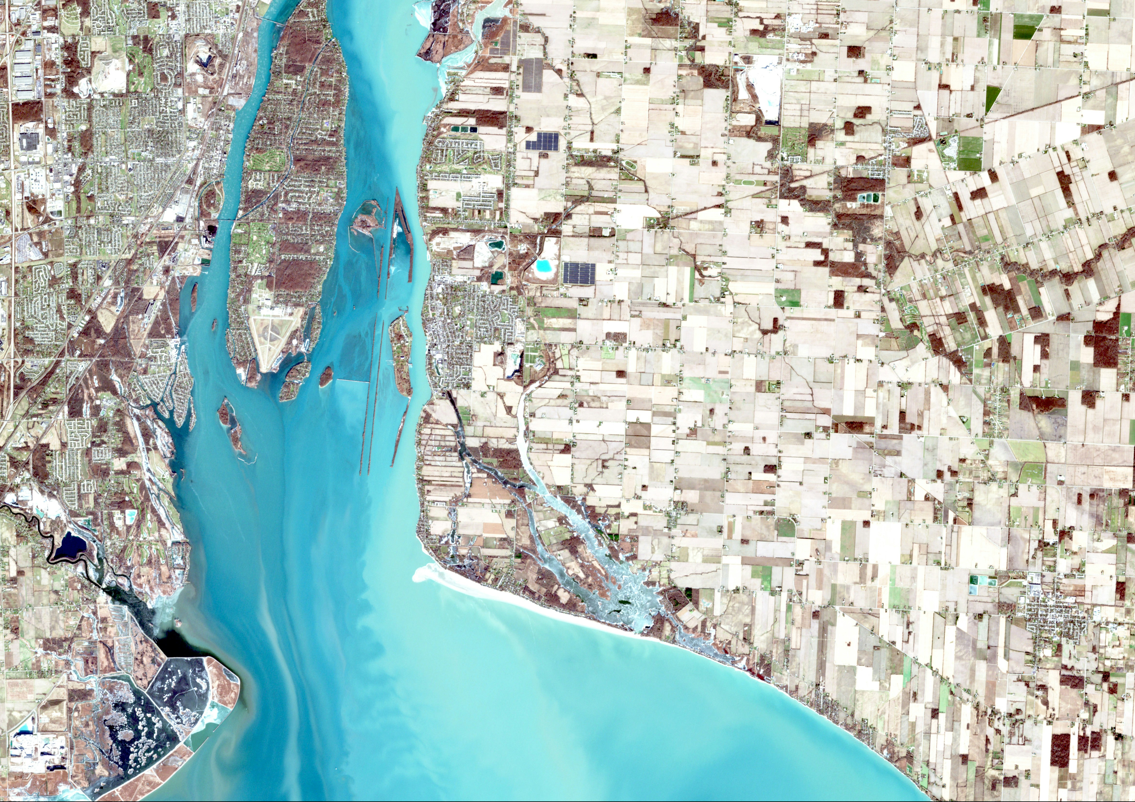
Preparation and evaluation of aerial and satellite images You analyze image data from various perspectives to calculate exact coordinates and surface information. This data is used, among other things, for maps, construction planning or environmental analyses.
3D modeling and mapping With the help of special software, you generate three-dimensional models of buildings, cities or terrain structures. These models serve as a basis for decision-making in urban planning or for digital twins, for example.
Quality control and data preparation So reliable from image data Geoinformation Become, do you check raw data Accuracy, completeness, and consistency — and prepare them for GIS or CAD systems.
Tools & technologies in photogrammetry practice
Modern photogrammetry jobs require a safe use of specialized software and digital workflows. You should know these tools:
photogrammetry software Commonly used programs include:
Agisoft Metashape (structure-from-motion, 3D reconstruction)
Pix4D (especially with drone images)
RealityCapture (fast processing of large data sets)
Diverse data sources The image data comes from various platforms:
drones (UAVs): flexible & cost-effective for small areas
planes: for large-scale mapping
satellites: for global or hard-to-reach regions
Interfaces to GIS, CAD and BIM Data is often exported or directly integrated into:
BIM platforms (Building Information Modeling) in building construction
Who is hiring? — Overview of employers and industries
Professionals with knowledge of photogrammetry and remote sensing are more in demand than ever, in very different industries and types of companies. Whether established surveying offices or innovation-driven start-ups: The job market offers many options.
Typical employers in photogrammetry
Depending on professional orientation, project interest and career level Can you join different types of employers:
Engineering and surveying offices These companies are strong in technical implementation of construction and infrastructure projects integrated. They regularly need specialists for photogrammetric analyses, field surveys and 3D modelling.
GIS and cartography companies Companies with a focus on Geographic information systems (GIS) rely on photogrammetry to collect, process and visualize geodata. Here, you often work in interdisciplinary teams with developers and analysts.
Public Service & Research Institutions Offices for state surveying, environmental authorities and universities offer secure jobs with social benefits — for example in Long-term monitoring of environmental changes or the development of new methods in remote sensing.
Smart City, Digital Twin & Drone Technology Start-ups The start-up scene is heavily reliant automated, cloud-based workflows — for example when recording urban spaces or connecting 3D data with real-time sensors. Anyone with an affinity for technology will find creative fields of activity here with plenty of creative leeway.
Booming industries with photogrammetry requirements
The need for photogrammetric expertise is growing rapidly, particularly in the following sectors of the economy:
Construction & infrastructure planning Whether bridge rehabilitation or major construction projects: 3D models based on image data are now standard for planning, control and construction documentation.
Environmental monitoring & forestry Vegetation analyses, erosion mapping or wildlife observation — all of this is increasingly based on remote sensing technologies, in which photogrammetry plays a key role.
Disaster Management & Security Services When recording the situation after natural events (e.g. floods, landslides), photogrammetric methods provide quick and accurate basis for decision-making for emergency services.
Energy industry & pipeline documentation Power lines, pipelines or wind farms — the regular inspection and digital inventory is often carried out via drone flights followed by photogrammetric evaluation.
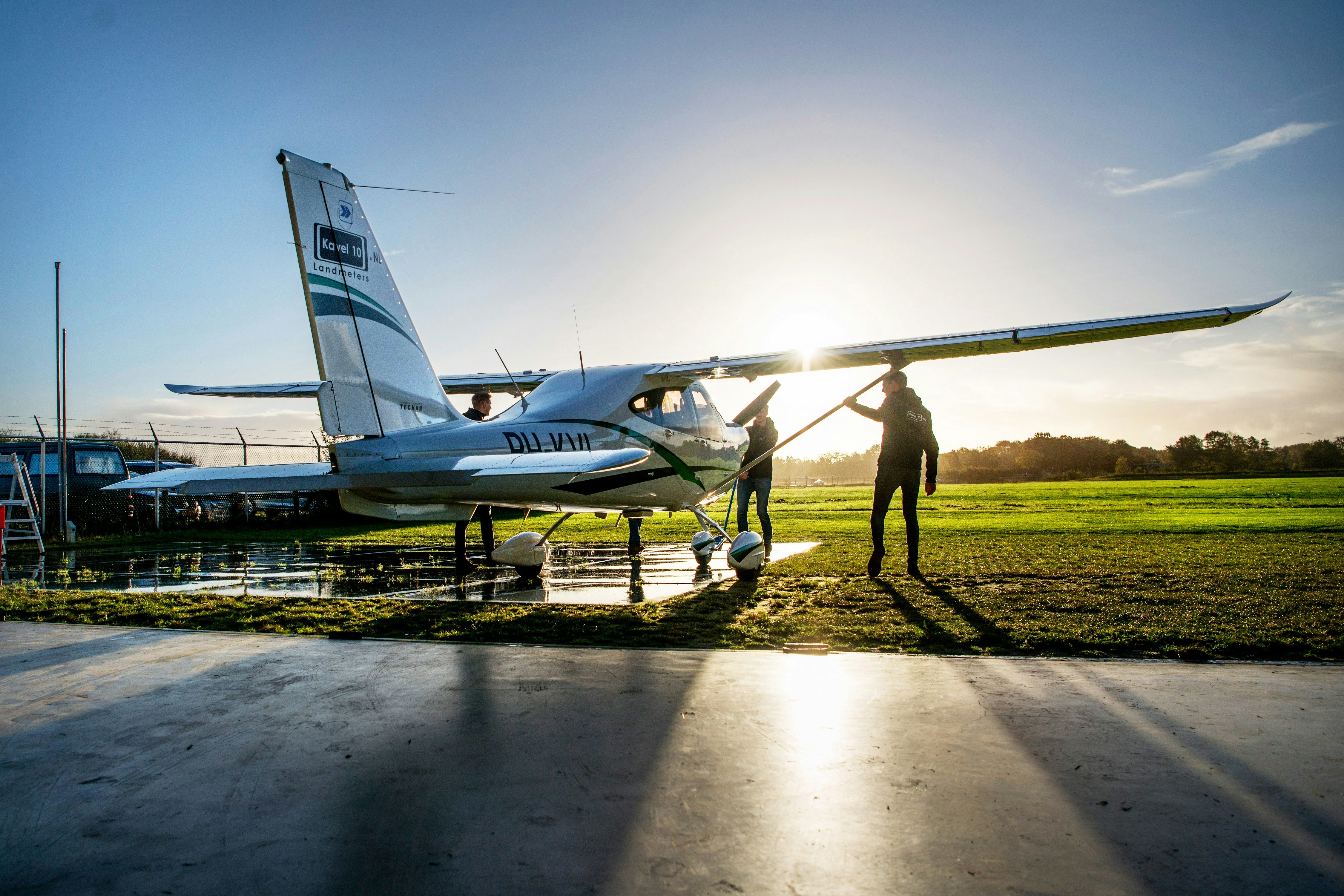
With the increased use of powerful drones, photogrammetry work is becoming easier and cheaper
Career Paths & Qualifications in Photogrammetry
There are many ways to get started in photogrammetry — whether classic through a course of study, practical through training or flexibly through lateral entry. Technical understanding, good spatial awareness and the safe use of software tools are important. In this section, you will learn how to successfully position yourself on the job market and which continuing education will help you move forward.
Entry opportunities for career starters
Anyone new to the world of remote sensing and photogrammetry should look for a sound technical basis. Classic ways to get started are:
Studying geoinformatics, surveying or remote sensing Universities and universities of applied sciences offer specialized courses of study, e.g. a Geoinformatics degree, which prepare you for tasks in image processing, 3D modelling and geodata analysis in a practical way.
Training paths with a technical focus Auch geomatist or surveyor With additional training in the area of remote sensing, you can successfully join photogrammetry teams.
Lateral entry with software skills and data understanding Who already has knowledge of 3D software, CAD, GIS or drone technology , can score points with project-related experience and willingness to learn — especially in innovative start-ups or interdisciplinary teams.
First steps: internship, working student position or trainee program Early practical experience is often the door opener — ideally in the environment of GIS service providers, planning offices or research institutions.
Continuing education & specialization
Photogrammetry is rapidly evolving — who Stay tuned, remains in demand. These continuing education paths can specifically advance your career:
Certificate courses for drone pilots & image evaluation Drones are becoming increasingly important in remote sensing. A certified drone driving license (e.g. EU certificate of competence A2) and image processing courses significantly increase your chances.
Software training & tool expertise Knowledge of tools such as Pix4D, Metashape, QGIS, or AutoCAD are a prerequisite for many job offers — and can be specifically deepened in courses or e-learning.
Specialized master's programs or part-time courses If you're in the long term in Project management or research If you want to work, a postgraduate degree offers in-depth methodological and technical knowledge.
Industry networks & events Professional events, online communities and conferences such as INTERGEO, FOSSGIS, or GeoWeek help you get in touch with employers and colleagues — and learn about new developments at an early stage.
Tips for applicants: How to find the right photogrammetry job
If you want to gain a foothold in photogrammetry, not only is your professional know-how decisive — but also a clever application strategy and targeted search. In this section, we'll show you where to find suitable photogrammetry jobs, what employers expect and how to impress with your application.
Where to find photogrammetry jobs
Many classic job boards only list a few suitable jobs for remote sensing specialists. That's why it's worth looking at specialized sources:
Industry portals such as GoGeoGo Here you can find targeted Vacancies in photogrammetry and related geoprofessions, often with additional filter functions by tools, region or employment type.
LinkedIn, XING and geo-communities Actively use platforms to target Jobs in the area of geoinformation, 3D modelling or drone surveying to become alert. Many employers also advertise internships and working student positions here.
Professional events & university contacts Events such as INTERGEO or the DGPF Symposium offer networking opportunities and direct access to HR managers. Auch University career centers regularly recruit positions in the geo-sector.
What employers pay attention to
You'll often find clear requirements in photogrammetry job ads. In order to stand out positively, you should keep these points in mind:
Technical expertise with practical relevance Employers are not looking for theorists, but Makers with software knowledge. Experience with tools such as Pix4D, Metashape or GIS software is often one of the must-haves.
Care & spatial thinking Since it involves accurate data, Accuracy, systematics and good spatial awareness essential.
Interdisciplinary work Find lots of projects at the interface with planning, IT or the environment instead of — the ability to work in a team and strong communication skills are required.
Application tips for photogrammetry
A remote sensing application should show more than just grades:
Portfolio with projects Include work samples such as 3D models, map visualizations, or screenshots of workflows with — ideally with a brief description of your role.
Make certificates visible Drone driving licences, software training courses or GIS courses belong prominently on the curriculum vitae.
Focus on problem solving in your cover letter Show how you do with your work solved specific tasks — such as closing data gaps, automating models or speeding up processes.
Modern techniques, such as creating digital twins for cities, also require photogrammetry skills
Conclusion: Photogrammetry jobs — geodata with a future
Photogrammetry is a dynamic professional field with rapidly growing importance — not only in traditional surveying, but also in innovative industries such as smart cities, environmental monitoring or digital twin technology. Jobs in photogrammetry combine technical know-how, an understanding of space and modern software expertise.
Whether you are studying, completing an apprenticeship or a career change: Anyone who is prepared to deal with tools, data sources and interdisciplinary issues will find excellent career opportunities here. Use specialized job boards, train yourself in a targeted manner — and visibly contribute your strengths to projects. This is how you secure your place in a professional field with a real future - you can find suitable jobs at GoGeoGo!
faqs
What requirements do I need for a photogrammetry job?
As a rule, you need to study geoinformatics, remote sensing, surveying or comparable subjects. Even career changers with GIS, CAD or drone knowledge can get off to a successful start — in particular with project experience or continuing education.
How much do you earn in photogrammetry?
Salary varies significantly depending on industry, region and qualification. Starting salaries are usually approx. 38,000 — 45,000 €/year, with experience are up to 60,000€ or more possible — particularly in construction, industry or at specialized engineering offices.
Is knowledge of drone technology mandatory?
Not necessarily — but they are a big advantage, as many projects work with UAV data. An EU drone driving license (e.g. A2) and experience in image evaluation with software such as Pix4D or Metashape significantly increase your job opportunities.
Where can I find current job offers in the field of photogrammetry?
In addition to general job portals, it is worth looking at specialized platforms such as GoGeoGo, on which targeted Photogrammetry and remote sensing jobs Be advertised — including internships, working student positions and trainee programs.
Which software should I know for photogrammetry jobs?
Common tools include Agisoft Metashape, Pix4D, RealityCapture, often in combination with QGIS, ArcGIS, or CAD systems. For many jobs, basic knowledge of several of these programs is a clear advantage.
Geo professionals are more in demand than ever in 2025 — this guide shows employers how to specifically find, approach and successfully hire qualified GIS analysts, urban planners and environmental experts.
Geographical, environmental and planning professions are more in demand than ever due to climate change, urbanization and digitization and offer a wide range of career opportunities from GIS to urban planning to renewable energy.
Vienna offers geo-specialists excellent career opportunities in GIS, geodesy and urban planning with international employers and a high quality of life.
Over 150 employers have been advertising with GoGeoGo since 2022
Why not simply Indeed or Stepstone?
On generic job boards, a large number of irrelevant candidates see your ad. You pay for reach you don't need and spend hours on unsuitable applications. With GoGeoGo, you specifically reach geo-professionals.
Significantly fewer irrelevant applications → Your team saves screening time
Transparent pricing starting from €149. No packages, no minimum commitment
Personal consultation from geo-industry insiders, no call center, response usually on the same business day


.avif)


.avif)


.avif)