+500 new subscribers
Looking for Jobs?
By signing up, you agree to our privacy policies you can find on our website.
Perfect! We'll keep you up to date about current jobs from now on!
Oops! That didn't work out.
+500 new subscribers

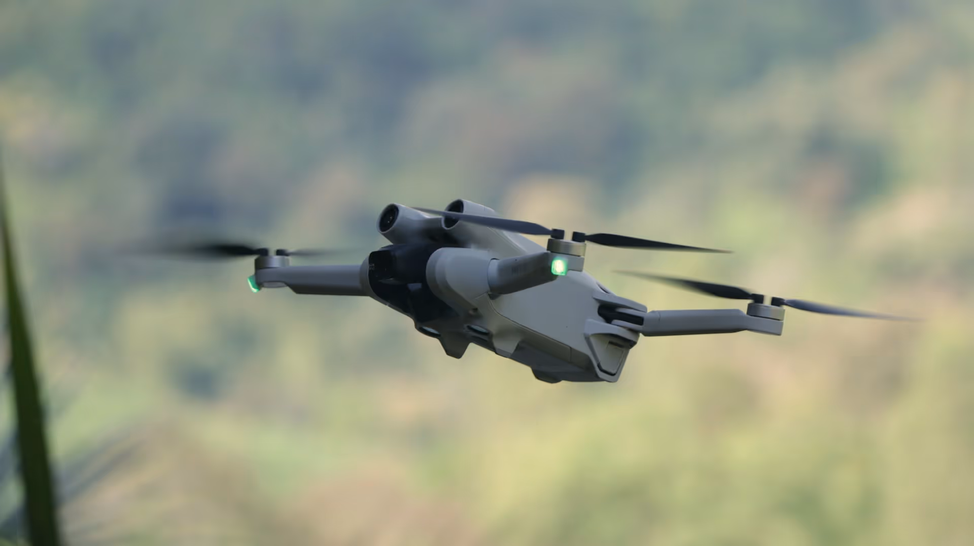
Drone pilots are more in demand today than ever — be it in the remote sensing, inspection, agriculture, media production, or even in the military. The tasks range from deployments in the field to planning and data analysis in the office. For technology enthusiasts, this job combines adventure, precision and future potential.
In this blog post, we'll show you What you need to get started, what areas of work there are, how much you can earn and where you can find suitable jobs as a drone pilot or pilot.
Latest Vacancies for drone pilots You can find it directly on GoGeoGo.
Today, drone pilots do much more than just remotely control an aircraft. In a professional context — particularly in the area of remote sensing and geoinformatics — Are they responsible for planning, implementing and following up on UAV missions (unmanned aerial vehicle), often with high technical and regulatory complexity.
Key tasks include:
Particularly important: drone pilots do not work in isolation, but often in teams with geodata analysts, engineers or environmental experts. Depending on the project, close coordination is required — both technically and methodically.

Drones are used across industries. The focus is often on Capture accurate spatial data, but also on visual inspection and documentation. The most important fields of application:
In remote sensing, drones deliver high-resolution aerial photos, which, for example, in landscape planning, for environmental monitoring or in resource management. Thanks to their flexibility, they can capture areas that are too small or inaccessible for manned aerial photography flights.
Construction companies use drones to construction site documentation, surveying and condition recording from bridges, roofs or roads. This often saves high inspection costs — while at the same time increasing safety.
With Floods, forest fires, or storm damage drones make it possible to quickly assess the situation. Even in nature conservation They are used, for example for wildlife census or vegetation analysis — data-based and with minimal disturbances.
Farmers and forestry companies use drones for Yield analyses, pest monitoring or distribution of beneficial organisms. Multi-spectral cameras in particular help to efficiently assess plant conditions. So-called precision farming, for example, is hardly conceivable without drone technology.
If you want to work professionally as a drone pilot, you need legally binding evidence and technical know-how. In the EU, the EASA drone regulation the commercial use of unmanned aerial vehicles. Since 2021, the following driving license classes have been in force, which are Federal Aviation Office The following can be completed:
Additionally asked:
tip: Anyone who wants to work in the open or specific operating category should also be able to use tools such as DroneDeploy, Pix4D or Agisoft Metashape.

The drone pilot profession is not only technical — it is also Sense of responsibility and precision are crucial. After all, you fly in sensitive areas and are liable for damage.
Important personal qualities:
Access to work is multifarious. There is no traditional “drone pilot” training profession, but there are established ways of studying and continuing education:
Also a Lateral entry is realistic — for example for technicians, photographers or GIS professionals who expand their skills with drone training. Decisive are verifiable flight practice, certificates and reference projects.
The need for qualified drone pilots is growing across industries. They are particularly in demand wherever precise air data in a short time must be collected and evaluated. Employers range from small surveying offices to large construction companies, public authorities and environmental organizations.
Typical employers include:
The UAV market is changing rapidly — the requirements for drone pilots are also evolving. Particularly relevant:
These developments require continuous further education — and offer at the same time attractive specialization options.

Not all drone pilots are permanently employed. The job market offers various models:
The salary of drone pilots varies widely — depending on Sector, qualification, region and type of employment. In Germany, the average annual gross salary is currently:
According to a survey by the Federal Association of Civil Drones e. V. (BVZD) achieve self-employed people with their own equipment during project work Daily rates from 350 to 800€, depending on the area of application and equipment.
Factors influencing salary:
If you want to make a long-term career as a drone pilot, there are various paths open — particularly through Technical specialization and interdisciplinary continuing education.
Popular specializations:
In addition, experienced drone pilots can also grow into the following roles:
Anyone applying for drone pilot jobs should not only bring a resume, but also practical project evidence and technical qualifications substantiate.
Important documents & recommendations:
tip: Create a digital portfolio with aerial photos, 3D renderings or mapping — ideally with a description of the technology used.

drone pilots are now an indispensable part of modern geodata work, environmental monitoring and technical inspections. Who is ready to join Technology, aviation law and data processing In this professional field, A wide range of applications with a future.
What is important is:
Whether in the farming, at Infrastructure monitoring or in public service — the job is varied, sought after and technologically exciting.
Are you currently looking for a suitable job as a drone pilot? Then take a look at the current job offers GoGeoGo!
How much do you earn as a drone pilot?
Depending on industry and experience between 30,000 and 60,000€ gross annually. Self-employed people often achieve daily rates of between 350€ and 800€, depending on the order and technology.
Do I have to get a drone license?
Yes — for almost all commercial flights is at least the EU certificate of competence A1/A3 required. In many cases, the A2 certificate requires.
Can I also work as a drone pilot without studying?
Yes In addition to academic training, Career changers with technical or geodata-related background highly sought after — such as surveyors, or GIS specialists.
Sign up for new jobs
+500 new subscribers


.avif)


150+ employers advertise here since 2022

.avif)


Receive geojobs regularly.