+500 new subscribers
Looking for Jobs?
By signing up, you agree to our privacy policies you can find on our website.
Perfect! We'll keep you up to date about current jobs from now on!
Oops! That didn't work out.
+500 new subscribers


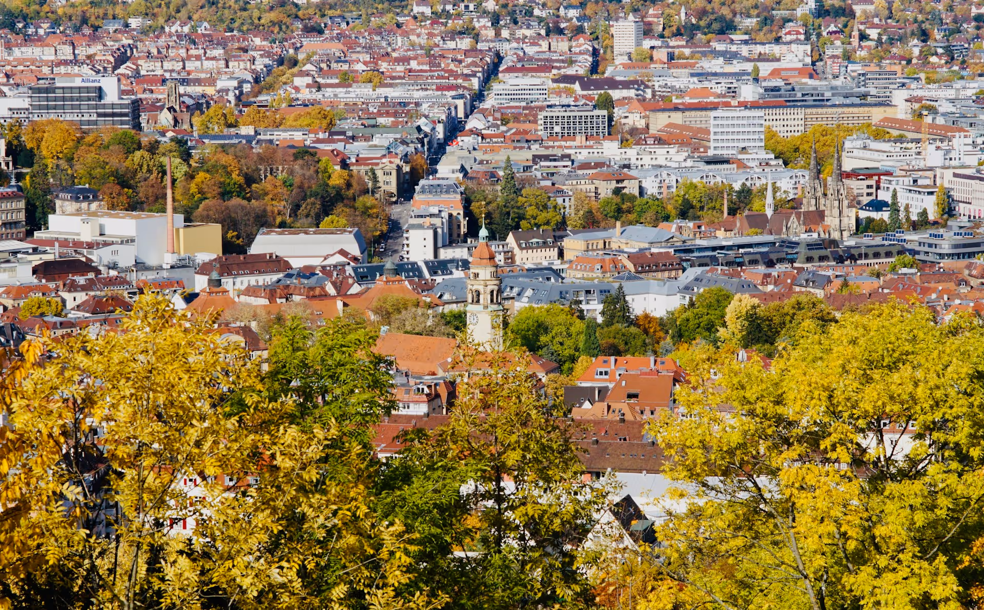
Kassel — capital of the North Hessian region with around 210,000 inhabitants — is a unique job market for geoinformatics specialists with a global focus on forestry and GIS solutions. The city combines tradition (cultural heritage, former princely residence) with a modern focus on tech: INTEND Geoinformatik, headquartered in Kassel, is the global market leader for GIS solutions in forestry with 50+ employees and 8,000+ customer installations worldwide. In addition, there is the University of Kassel (with Department of Geography and Portal for Geodata & GIS), the Hessian Administration for Land Management and Geoinformation (HVBG, 1,400+ employees with North Hessian branches), and the modern city of Kassel with a growing GIS focus in surveying and urban development. Special feature: Global focus on forest GIS — INTEND is world-renowned for digital forest management. For geoinformatics specialists, GIS specialists, surveyors and environmental professionals, Kassel offers a specialized, internationally oriented ecosystem with career opportunities in digital forest management, public administration and modern planning projects.
The job market in Kassel is specialized with a clear focus on Forest GIS and forest management, supplemented by public surveying authorities and environmental planning.
Forestry & Forest Management — GLOBAL Focus with INTEND
Kassel is world-renowned for digital forest management. INTEND Geoinformatik GmbH, founded in 2000, is leading provider of GIS solutions for forestry in Germany and Europe with over 50 employees. INTEND products are used daily by 8,000+ customers to manage 3.5 million hectares of forest worldwide.
INTEND focal areas:
Career opportunities with INTEND: GIS specialists, software developers, geoinformatics specialists, forest management specialists, customer success managers. Regular job advertisements with an international focus (target group: state forests, private forestry companies, timber industry). Jobs in GIS Kassel are created here with a global player perspective.
Geoinformatics & Surveying — University + Public Administration
The University of Kassel offers the Department of Geography (FB05) and Portal for Geodata & GIS (FB06) with a focus on geoinformatics and surveying. The Department of Surveying (FB14 BAU) for Civil and Environmental Engineering offers training and study programs in geoinformatics and surveying. Career opportunities: Research assistants, doctoral students, lectureships in geoinformatics and geography.
The city of Kassel itself is an important employer with an Office for Surveying and Geoinformation, which provides surveying services for urban construction projects, transport projects and infrastructure. The city of Kassel also offers dual bachelor's degree (Bachelor of Engineering — Surveying and Geoinformatics with THWS) with guaranteed employment opportunities. GIS Jobs Kassel are regularly created in surveying and urban development projects.
Spatial Planning & Urban Development — Modernity & Growth
Kassel is continuously modernizing with a focus on sustainable urban development, climate protection and transport turnaround. GIS integration in spatial planning creates opportunities for spatial planners and environmental planners. Large planning offices (e.g. HPC, specialized in land recycling and environmental consulting, with branch in Kassel) offer jobs in environmental planning and GIS analysis.
Surveying & Soil Management — HVBG Nordhessen
The Hessian Administration for Land Management and Geoinformation (HVBG, 1,400+ employees in total) is Hesse's central authority for surveying, cadastre and geoinformation with offices in Homberg (Efze) and Korbach for North Hesse. HVBG tasks: state survey, real estate register, land reorganization, geoinformation and INSPIRE directive implementation. Career opportunities: Training (geomatician), dual study with Frankfurt UAS, upper/higher service civil service training, direct entries for surveyors and GIS specialists.
Environmental Planning & Conservation — Steady Demand
Kassel region with North Hesse forests, proximity to the national park and environmental protection projects generates continuous demand for environmental planners, landscape planners and nature conservation experts. Environmental jobs in Kassel are often created in planning offices (HPC, TAUW, GEO-NET) and nature conservation projects with a focus on GIS.
Living in Kassel — cultural city with green & cheap
Kassel is one of the cheapest major cities in Germany with moderate rents (25— 35% cheaper than Munich/Hamburg) and excellent housing offers. Popular districts: Südstadt with parks and cultural life, Bettenhausen family-friendly, Wilhelmshöhe elegant with UNESCO Wilhelmshöhe Palace. Kassel is known for its cultural heritage (Documenta Museum, UNESCO Castle), museum landscape and green infrastructure. The city offers excellent value for money with a high quality of life.
Transport connection — Germany-Central
Kassel is centrally located in Germany in terms of transport: by train to Frankfurt (1.5 hours), Berlin (4 hours), Munich (6 hours) — important tech/financial centers. Local: Trams and buses connect districts. Excellent bicycle infrastructure — Kassel is bicycle-friendly. By car: The A7 motorway (Hanover—Fulda) offers quick connections. Close to the forest region and Harz National Park.
Leisure & relaxation — culture & nature combined
Kassel is a leisure metropolis: UNESCO Wilhelmshöhe Palace with park (water games!) , Documenta Museum (Art Triennial), museum landscape, river cycle paths (Fulda), forest region and proximity to the Harz Mountains for outdoor use. Cultural: State Concert Hall, State Theatre, lively art scene. For families: parks, museums, green spaces. Forest and cultural life are at the core of Kassel's identity.
University of Kassel — Geography & Geoinformatics
The University of Kassel has around 27,000 students specializing in geography (FB05 Social Sciences) and portal for geodata & GIS (FB06 Architectural Urban Planning).
Geography offer:
Survey offer (FB14 BAU):
Career opportunities: Scientific staff, doctoral students, lectureships in geoinformatics, geography and surveying. With a university degree: Direct access to INTEND jobs and HVBG careers.
INTEND Geoinformatics — Global Forest GIS Leader with 50+ employees
INTEND is a world-renowned specialist for GIS solutions in forestry with headquarters in Kassel. Founded in 2000, over 50 employees, 8,000+ customers worldwide, 3.5 million hectares of forest under management. Core products: digital forest management systems, forest GIS, timber transport optimization, sustainable forest management.
Fields of work at INTEND:
Career opportunities: GIS specialists, software developers, geoinformatics specialists, forest management experts, business analysts. INTEND offers opportunities on the international stage — many customers are European state forests (Black Forest, Bavaria, Austria). Start-uplike culture with flat hierarchies.
Hessian Administration for Land Management and Geoinformation (HVBG) — 1,400+ employees
HVBG with 1,400+ employees is Hesse's central authority for surveying, cadastre and geoinformation with 7 offices (including Homberg/Efze and Korbach for North Hesse). HVBG tasks: state surveying, real estate cadastre, land reorganization, geodata infrastructure and land management.
Career opportunities:
HVBG offers public service security + modern GIS tech + international INSPIRE implementation.
Future trends & job prospects
Kassel and northern Hesse benefit from:
For geo-specialists, Kassel is a unique, internationally oriented job market with a global focus on forest GIS and stable prospects.
Kassel is a highly specialized job market for geo-specialists with a unique focus on forest GIS. From a global market leader (INTEND with 50+ employees, 8,000+ customers worldwide) to a massive surveying authority (HVBG with 1,400+ employees) to innovative environmental and planning offices — Kassel's employer landscape is specialized, international and shaped by forestry. This overview presents the top employers for geoinformatics specialists, GIS specialists, surveyors and environmental professionals in Kassel.
The Department of Geography is part of Department 05 Social Sciences with around 27,000 students. With Prof. Dr. Frauke Kruckemeyer (Physical Geography, Landscape Ecology, Sustainable Spatial Development) as a leading figure, the institute is researching landscape ecology, sustainable spatial development and geography didactics.
Teaching & research:
Career opportunities: Scientific staff, doctoral students, postdocs, lecturers in geography, landscape ecology and geoinformatics.
Relevant positions: Scientific Staff, Doctoral Students, Lecturers
→ www.uni-kassel.de/fb05
INTEND Geoinformatik GmbH, headquartered in Kassel, is world-renowned market leader for GIS solutions in forestry Since its founding in 2000. With over 50 employees and 8,000+ customers worldwide, INTEND systems are used daily to manage 3.5 million hectares of forest.
Core products & focal areas:
Customer base:
Career opportunities:
Special feature: Internationally oriented employer with a global customer base — opportunities for project work in Europe, Scandinavia, Eastern Europe. Start-uplike culture with flat hierarchies, a modern tech stack and a passion for forest management.
Relevant positions: Software developers, GIS specialists, geoinformatics specialists, forest management experts, customer success managers
→ www.intend.de
HVBG with 1,400+ employees in total is Hesse's central authority for surveying, cadastre, geoinformation and sustainable land development. Structure: Hessian State Office for Land Management and Geoinformation (HLBG, Wiesbaden Intermediate Authority) + 7 Land Management Offices (AeFB) with branch offices. Responsible for North Hesse: Homberg (Efze) and Korbach Land Management Office.
Tasks & competencies:
Career opportunities:
Special feature: Germany's leading authority in geodata infrastructure and sustainable land development. Public service security with modern tech and international INSPIRE work.
Relevant positions: surveyors, geomatists, GIS specialists, geoinformatics specialists, land reorganization managers, trainee civil servants
→ hvbg.hessen.de
The Office for Surveying and Geoinformation is responsible for surveying services for public construction projects, transport projects and infrastructure in the city of Kassel. With modern GIS and surveying equipment, Kassel regularly offers positions in surveying and geoinformation.
Key areas of responsibility:
Career opportunities & education:
Relevant positions: Surveyors, geoinformatics specialists, GIS specialists, candidates for dual studies
→ www.kassel.de
HPC is one of the largest European service companies in land recycling, environmental consulting and infrastructure planning with a branch in Kassel. The environmental planning department (Kassel branch) regularly employs GIS specialists and environmental planners.
Priorities in Kassel:
Career opportunities: Landscape planners, environmental planners, GIS specialists, environmental engineers, project managers for environmental projects.
Relevant positions: Landscape planners, environmental planners, GIS employees, environmental engineers
→ [Local research HPC Kassel]
Kassel and North Hesse have specialized environmental consultants and planning offices that employ landscape planners, environmental engineers and GIS specialists.
examples:
Relevant positions: Landscape planners, environmental planners, GIS specialists, wind energy consultants, project managers
Sign up for new jobs
+500 new subscribers


.avif)
Receive geojobs regularly.